daily cardio: FR 71C and a goatherd shelter
I wanted to recon further up the road to see what was up there. Particularly if there were good sites to remember for a future visit. Muffin and I headed up the road.
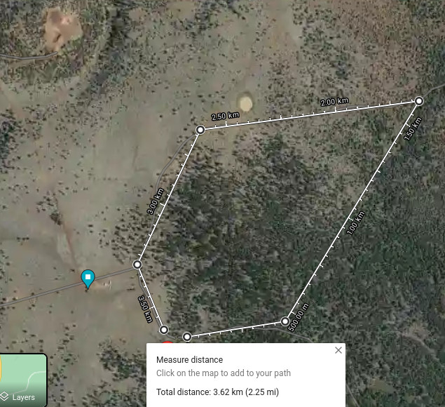
In this model we started from the lower left and went counter-clockwise. The tree canopy is heavy in places so the cut across the forest area is an estimate.
FR 116A to FR 71C
The first segment (heading east) had one good/deep site, but it was heavily canopied. Better for someone who doesn’t run off solar.
We turned north at the intersection with FR 71C.
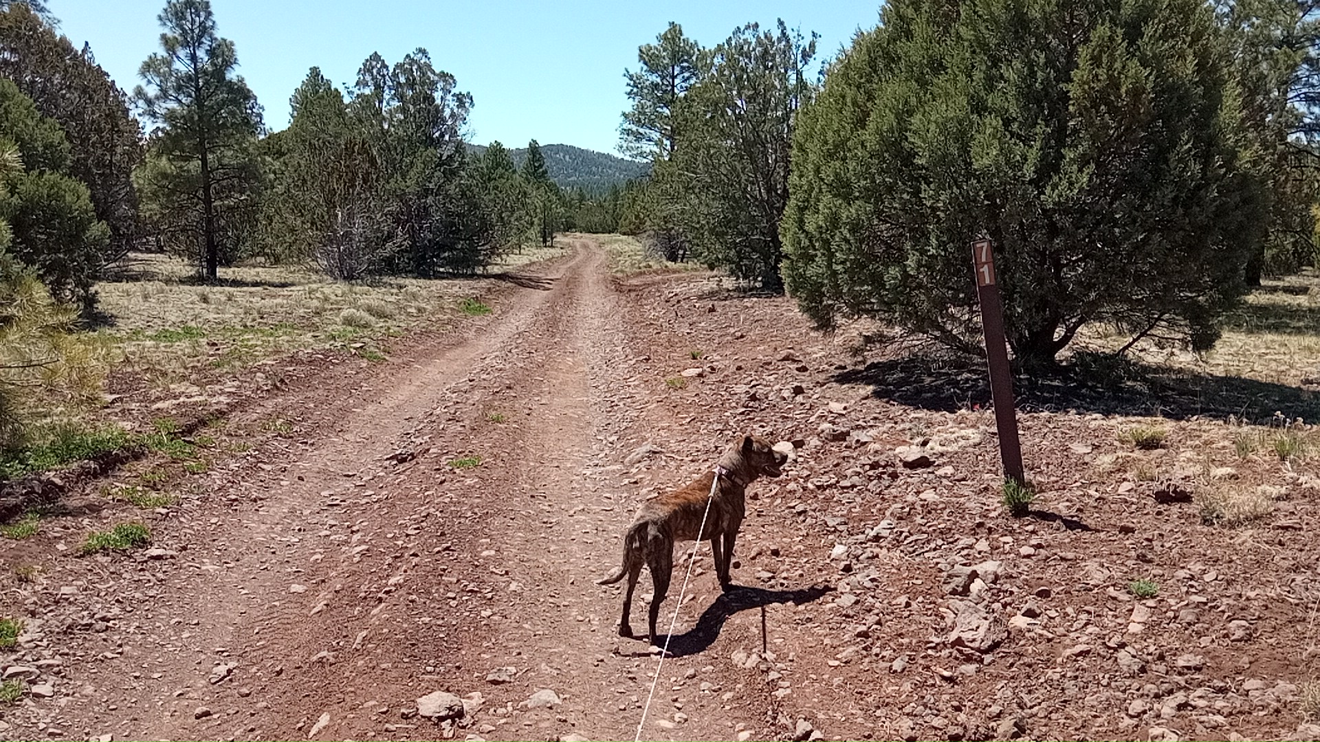
FR 71C to FR 71
In the first 100 yards there was a nice open spot but zero cell reception.
Immediately after that the road got quite rocky, bad enough I wouldn’t drive on it if I had other options. It was uneven enough there were 2x I would have twisted my right ankle1 if I didn’t have it wrapped and been walking with a staff.
Trail conditions, combined with the utter lack of existing dispersed sites, made it rather unappealing. 71C didn’t show up on my mapping app (Osmand) but I figured it would ead-end into FR 71 on the north end so we trundled on.
About 3/4 the way up the northeastern segment I saw a building off the trail:
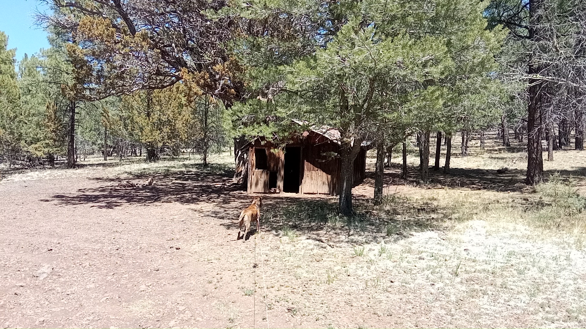
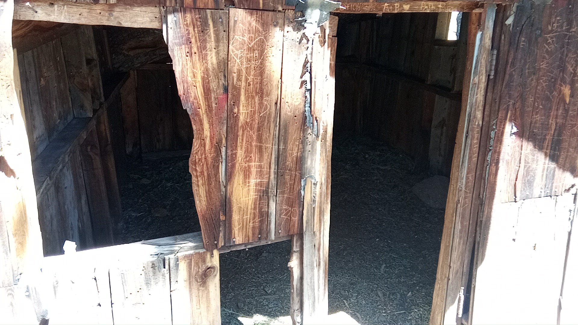
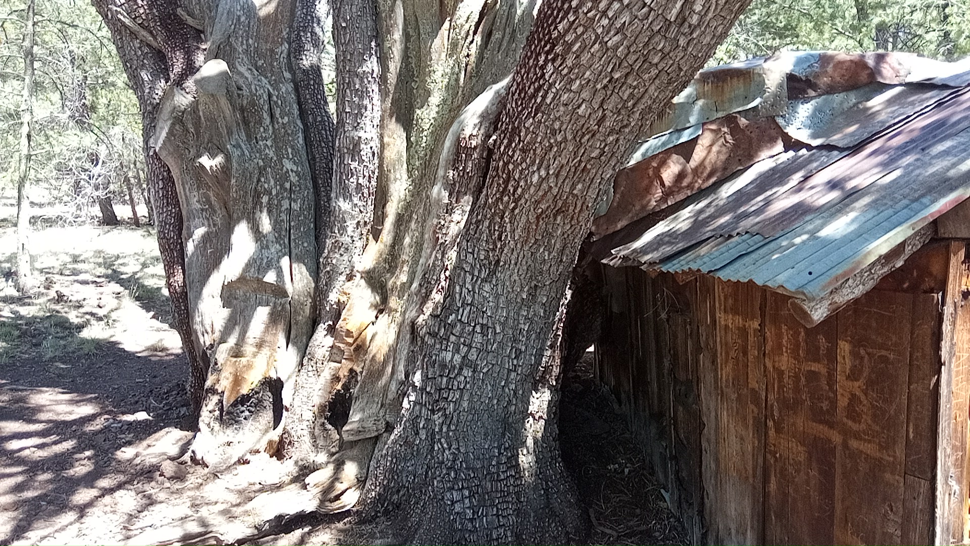
It is partially built into the adjacent massive tree; limbs puncture the back and front walls. The last pic is at an oblique angle but I’d say the tree[s] trunk is 8ft across, like it’d been cut open and unrolled.
I was wondering about it when a white pickup appeared, the only person I saw on the whole hike. I asked him what it was and he said goat herders had built it for shelter. He mentioned they thought the tree was special so maybe they built the shelter under the weird tree they had often rested under.
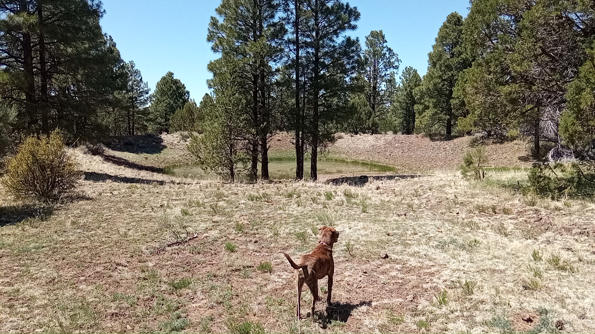
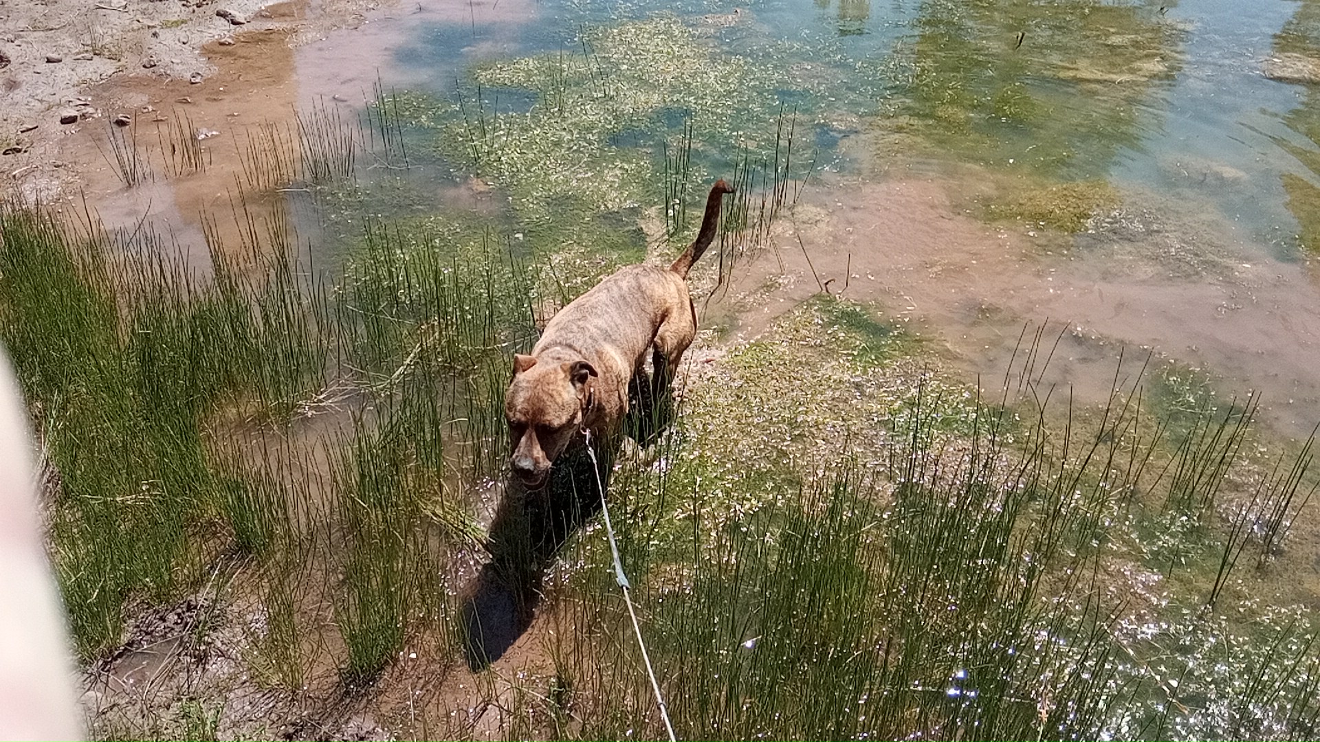
As we neared FR 71 there was one site and a pond to the western side. Muffin likes wading so I let her check it out:
There was one more site as we turned westward onto FS 71 (the topmost segment).
FR 71 to FR 116A
 The long walk back on 71 was on a good road surface (smooth, not rocky) and downhill but almost all unshaded. It was getting warm and the sun at 6800ft is rather strong; less air to filter the sunlight.
There were a couple exceptional spots on the westward leg I marked for later use. The southerly legs were in heavy use, and so not of much interest to me. Lots of generators, people leaving trailers and gear to “hold the spot”, etc.
home again, home again
Jiggety jig.
The final stretch leads us past the main road entering from the east, where you can see the blue waypoint symbol. There’s an open field where the bigger rigs congregate. More generators, screaming feral children, etc. I keep my distance to keep the blood pressure under control.
Here’s a pano view of the open field from our spot in the woodline a couple hundred yards southeast:
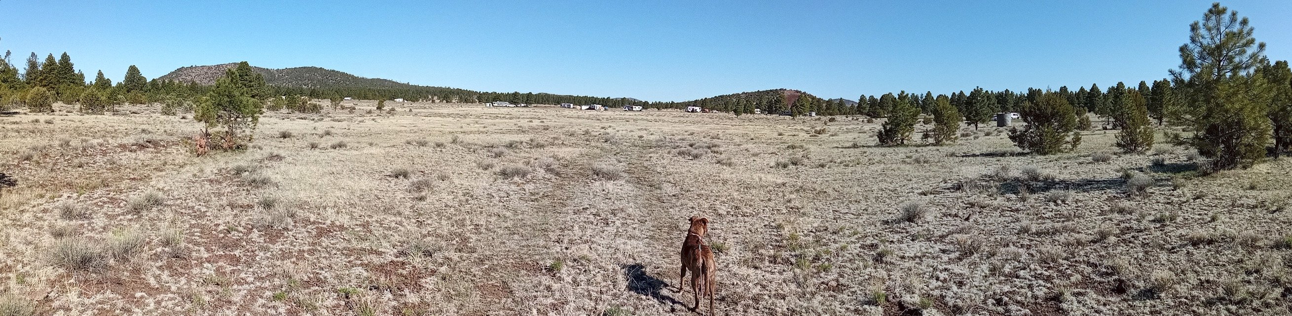
In the right side of the pano is an old water tank, I’m guessing 1000 gallons. Could have been for livestock, a homestead, or maybe for the rail line that must be nearby. I can hear the train every once in a while.
comments
twitter comment thread for this post
-
the one I dislocated in the Army. It’s a little weak so I wear a wrap or brace on it to keep it in the proper orientation. ↩